
Dev Log [7.7.26] - Mapping Xainol
In which Provost Madel of the Hegemony Cartographer's Guild maps the western and southern coastlines of Xainol.

“The journey south from the illustrious Calberek Harbor was without much hardship. The captain of the expeditionary vessel served under his Imminence, Ebrek VIII, fondly called the Mariner by his vassals, and has proven herself deft with the rudder even in the worst weather. I have developed a respect for Captain Lalin that I afford very few.
“We arrived within sight of this most strange land, which his Imminence named Xainol—it bearing some connection to the family name of his mother, or so I am told—after six weeks aboard ship. I must say, I much prefer the dust and dirt of a land-based cartographic expedition, the tossing and rolling of the waves wreak havoc upon my ability to write, much less sketch. I was greatly pleased to find the waters along the eastern coast of Xainol to be calm. It made mapping the coastline from the bow of Mariner’s Gale a significantly easier task.
“The captain believed the coast to be much too shallow to permit closer sailing, thus my mapping of the coastline, by necessity, is not as accurate as I would wish. She did permit me and a small crew of four to take a rowboat into a small inlet guarded by large rocks. One such rock was, itself, nearly an island. A tall frond tree grew in a small patch of sandy soil. Around the guarding stones, we discovered a sand bar and the sunbleached bones of a humanoid, though there have been no landings on Xainol by humans as far as I am aware. Along the coast, we also spotted odd trees whose mass of tangled roots reached down into the water instead of the dirt. One of the sailors manning the oars said they reminded him of the mangrove that grew on the south-western coast of the continent where he was born. Perhaps they are a subspecies of the same tree? I am no arborist, but perhaps they could be dubbed Madelgroves.”
— Xainol Expedition Journal of Provost Madel, Cartographer’s Guild
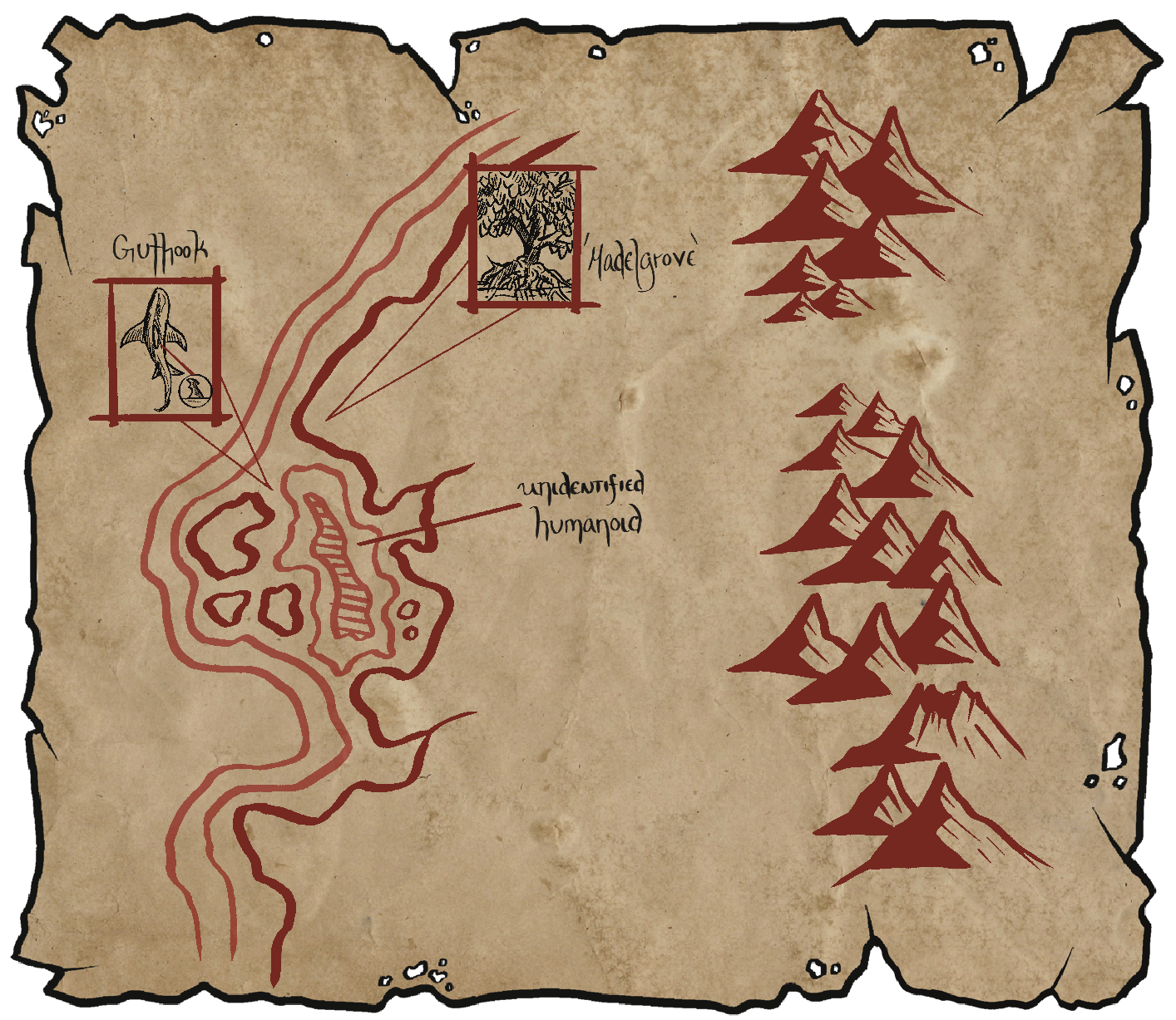
One of the fundamental truths of fantasy map-making is that maps should tell a story. You should be able to look at a map and see a kind of narrative evolving, whether it’s the shape of the coast or the style of tree or mountain the artist has chosen, or any number of artistic choices. Rounded mountains can indicate a more peaceful, wholesome world, while sharp peaks might suggest danger. The same can be said of trees: using round shapes (deciduous-style trees) over triangular (pine-style trees) can tell the viewer a little bit about how the artist sees the world they are drawing/narrating.
In beginning to sketch out the map for Xainol, I went into it with the intention of telling a story, and, as you can see, the story really took root. I decided to start with the first Hegemony expedition to map out the coast of the island. Why? Well, there’s a couple of reasons.
First, I wanted to try to be at least a bit realistic with how the first maps of the island came to exist. At the time Provost Madel is making his map of Xainol, there is no knowledge of the natives and no Hegemonic settlements have been set up. We already know the Anuran, Pteron, and Pufforell peoples inhabit the island, but Madel does not. There will be other expeditions that attempt to go inland and map out more of the island—at least one of those goes completely missing! Which leads me to my next reason.
As Xainol is a game setting I wanted to be careful not to over design. The coastlines establish boundaries, and the lore we set up for the three native ancestries give us some general topography, flora, and fauna. But I want to keep the interior largely blank and ripe for player discovery and creation. Having Madel’s expedition sketch out the coastlines and give some information on the coastal flora and fauna allows me to be creative in my worldbuilding—which is my favorite thing about solo TTRPGs—while also leaving room for players to create as well.
“We spent several days sailing down the eastern coast, as the wind turned against us and much of our time was spent languishing in the doldrums. When, at last, we turned westward round a small peninsula covered in towering, vine-draped trees of gray-brown bark. The sub-tropical forest marched west, disappearing from view only to rise again on the foot of the towering peaks that formed a kind of rocky spine along what I would eventually learn to be the relative center of the island.
“Captain Lalin was of the mind that the waters ran deeper along the southern coast, and allowed the ship much closer to shore, providing me with a much more detailed view—such as it was, obscured by the dense jungle. At least the rocky shore delineated the coastline quite well! On the third day in our westerly route, the lookout shouted down what I had seen only moments before: a bay, protected from the open sea by a shield wall of large rocks, really the remnants of the central ridge, I guessed, perhaps from when the bay had been above sea-level. It is also possible, given the shattered cone of one of the mountains visible in the distance, that the bay was a caldera that flooded with sea water. Whatever the case, the rowboat was sent out to plumb the depths. With a satisfactory report from her first-mate, Captain Lalin set a course for the bay itself.
“The bay proved quite large, perfect for an eventual fort and harbor should His Eminence seek to expand his influence. The rocky shore was much wider here than further east, giving plenty of room for the crew to anchor the ship and row ashore for a few hours. I, for one, needed the respite from the constant rocking of the ship. While on land, I determined that, indeed, many of the rocks making up the shore were igneous—having been formed by volcanic eruptions. My theory about the bay being a sunken caldera was growing in certitude. But I digress. Captain Lalin had a couple of the lads sink the Hegemonic Standard, the six-tusked boar upon an obsidian field, a good half span into the rocks. The land of Xainol was officially claimed as territory of his Eminence, Ebrek VII!
“It was a momentous occasion disrupted by strange voices, raised in raucous calls, from the jungle. One sailor reported seeing a lone hairy figure just barely visible within the tree-line. Another spoke of a featherless bird standing like a man upon a tree branch, some sixty spans high. Still others reported that they saw nothing, but heard what sounded like language, though one they could not understand, contained within the loud cries. Captain Lalin set a guard of pikemen while the two rowboats ferried us back to the ship as quickly as possible. I trust the Captain made note of this strange phenomenon in her log, but I too shall make certain it is in my report to His Eminence as well.
“We moved on once everyone was returned to the ship, all save two of the guards, who vanished without a trace. No one saw them go, nor heard any cry for help. The morale of the crew faltered for fear of what other dangers might await them. To appease their terror, the Captain declared there would be no more shore leave until the ship returned to known waters. I was disappointed, but kept my feelings to myself.
“We weighed anchor at dawn. As we came about, a great black bird soared over the mast toward the ocean. Its neck bore a most interesting adornment: a kind of sack, bright red with flecks of black or brown. Never have I seen such a great winged beast, though it was elegant with its gently curved wings and long-feathered tail. One sailor who worked near me muttered something about it resembling the great griffin of lore. It was no cat-eagle, but a true bird. Of that I have no doubt. I dubbed it ‘red-throated sea bird.’ Not particularly clever, I confess, and naming in my profession prefers descriptive functionality over creative naming. We saw nothing more for the next three days of sailing, save more of the towering jungle trees and rocky shore.”
— Xainol Expedition Journal of Provost Madel, Cartographer’s Guild
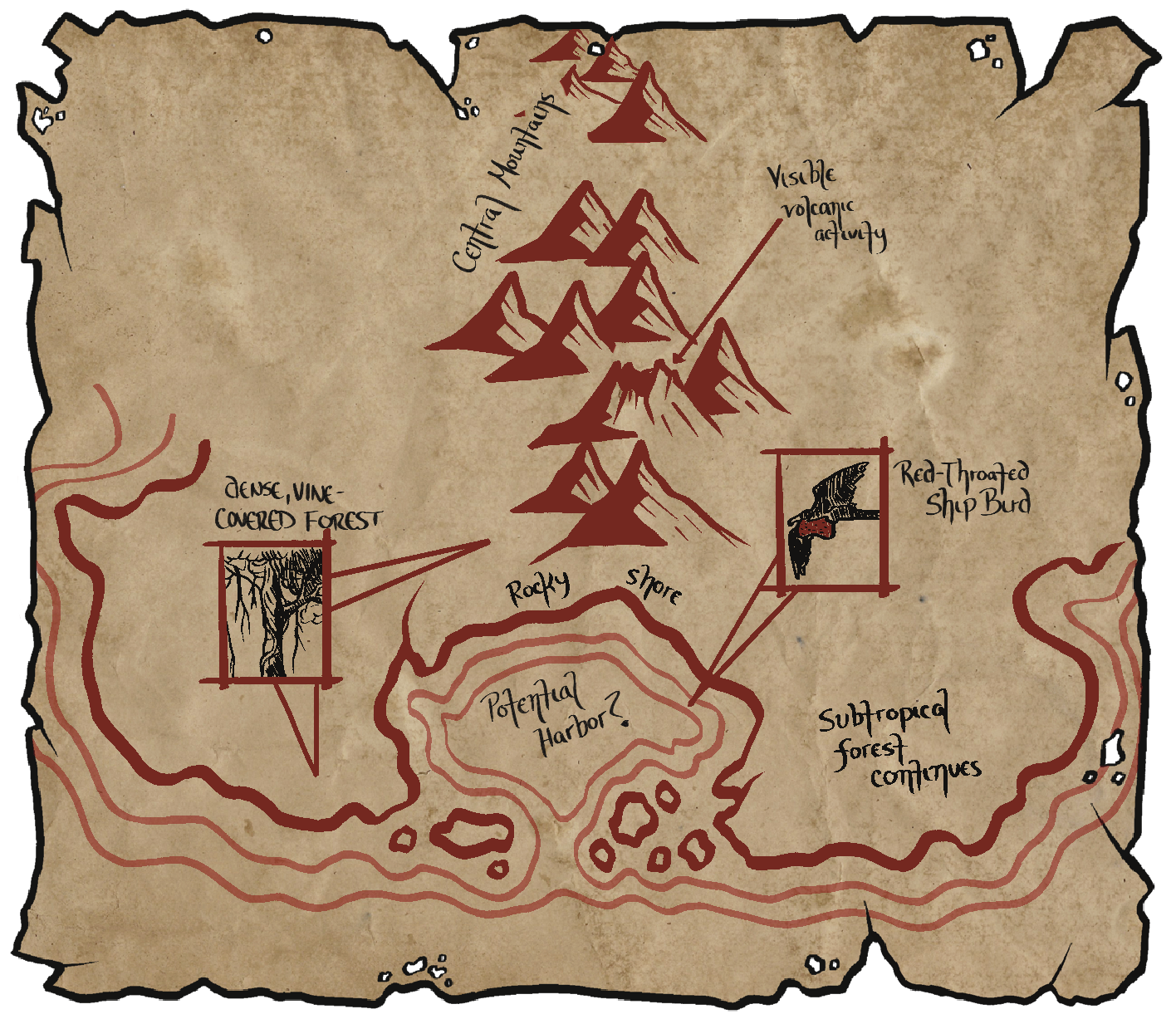
The mangroves—or “Madelgroves” as our arrogant cartographer has dubbed them—of the eastern coast are, of course, the native lands of the Anuran. The southern coast is largely undisturbed subtropical rainforests and stone beaches watched over by towering rocky mountains. The bay Madel and the Mariner’s Gale discovered will, in a couple centuries, become the primary harbor and trade center of Hegemony interests in the region complete with a fort and small town. This is one of the set locations that I intend to include in the game, though I haven’t considered a name for it yet. If you play as a human character, this town will likely be your starting point for your adventure.
You might have also noticed that the Pteron were alluded to in the fiction, the “featherless bird standing like a man” spotted by one of the sailors. Perhaps this was a Pteron scout who happened upon the landing party? I wonder what impact their report would have on Pteron society? Furthermore, another creature, described as a “lone, hairy figure,” was also mentioned. While I’m not intending to create another playable ancestry for Xainol just yet, it is possible there are other people groups on the island. Perhaps, like the Great Apes of Valenwood, they are an intelligent beast-people who inhabit the jungle regions. Or, maybe the legend of the Yeti persists on the Continent and fear led the sailor to see something from mythology in the trees (pareidolia). What do you think? Should we have other people settled on Xainol, akin to the apes in Planet of the Apes or Bigfoot?
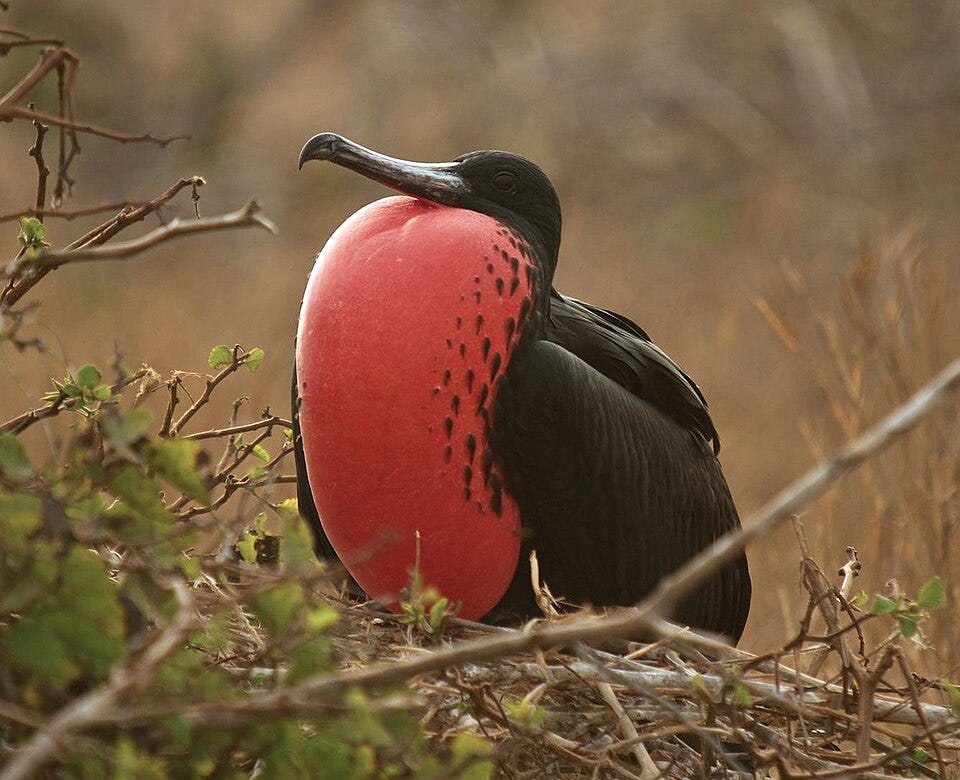
Dev Note: The “red-throated ship bird” was based on the Magnificent Frigatebird and was an attempt at fleshing out some of the animal inhabitants of Xainol.
.jpg)
There’s only two more areas to delineate for Xainol’s coastlines, which will be the contents of Thursday’s post (7/9). Do you have any ideas for things visible from the ocean?
Some form of Spire or dramatic ruin! I always remember being in the northern part of Vvardenfell with the little Island and seeing the ruins built into the rock. The maps look awesome, it's so cool to see it coming together!